Project concept · Use case 3 of 8
Mangrove island building and living shorelines
New mangrove islands built from clean sand the navigation district already holds.
Martin County, Florida · Florida Inland Navigation District (FIND)
The project
The problem
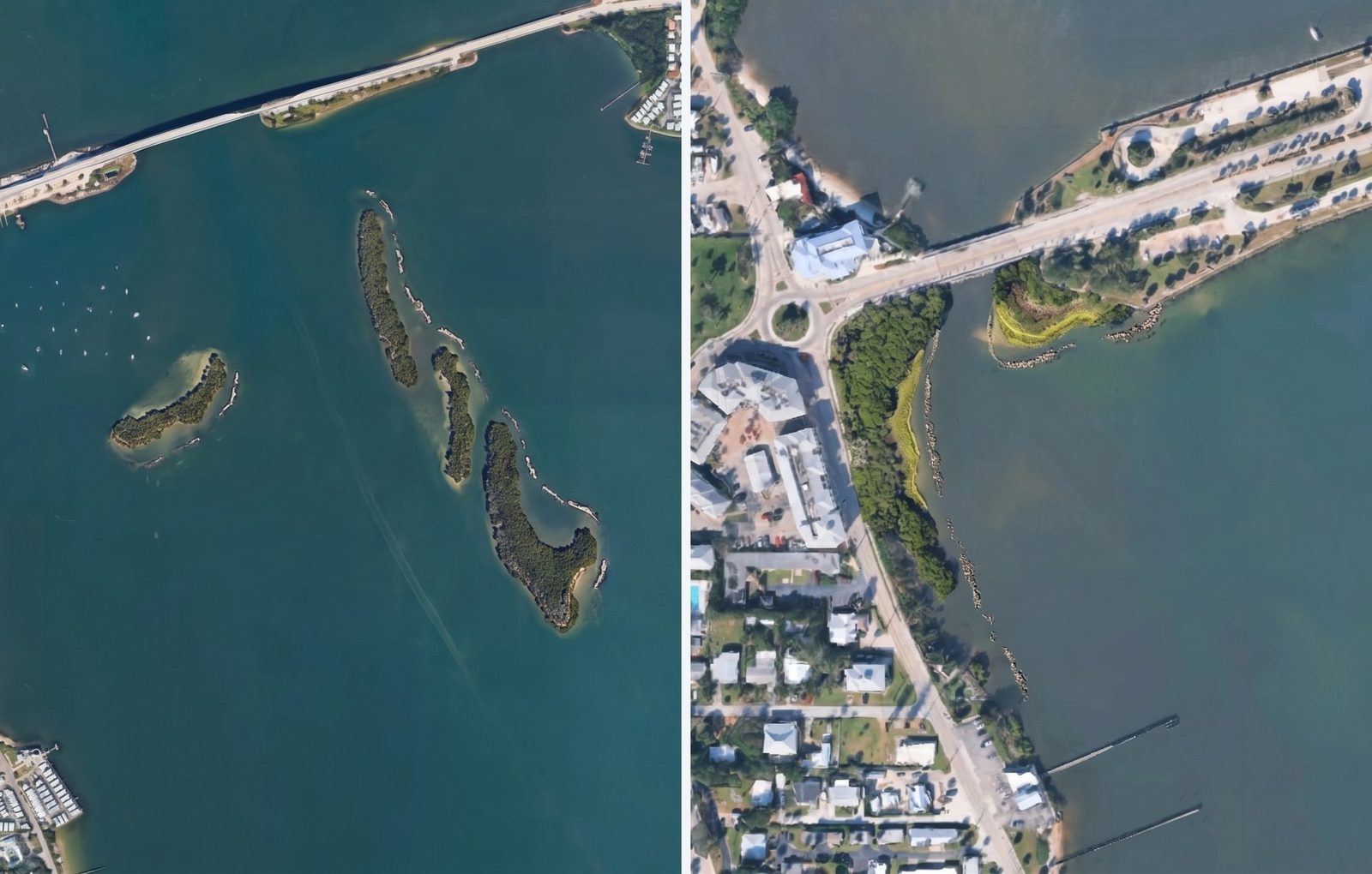
Shoreline along a busy causeway and waterfront road is eroding, and nearby shoals offer little wave protection or habitat. A seawall would harden the edge without adding habitat back.
What sets it apart
We mapped before we drew. Drone surveys, oyster reef and seagrass mapping, and site walks with Florida Sea Grant set where islands and planted shoreline could go, and where they shouldn't.
- Where
- Martin County, Florida
- Scale
- 4 mangrove islands on existing shoals and 5 planted shoreline reaches
- What we provided
- Drone survey, habitat mapping, island and shoreline layout, and renderings
Who helped shape this concept
- Martin County Asked us for ideas to restore islands and protect an eroding shoreline
-
 Florida Sea Grant Site walks and habitat mapping that set where islands and planted shoreline could go
- Florida Inland Navigation District Joined the county in asking for the concept, and holds the clean sand the islands would be built from
- C-HAWQ technical advisors Reviewed the island and shoreline layout
See it
Renderings, maps and media
-
Concept renderings prepared by C-HAWQ and partners.
Want to see the full concept? Ask us for it, and we'll share what's ready to be public.
How we got here
Where the project stands in our proven process
- 1. Discovery Done
The county and its navigation district asked us for ideas to restore islands and protect an eroding shoreline.
- 2. Development Done
Flew drone surveys, mapped 313 acres of oyster reef and 670 acres of seagrass, and laid out island and shoreline zones.
- 3. Mobilization Next
Briefings for county staff and leaders, then public meetings once the county picks a direction.
- 4. Close Next
We prepare a proposal the county can use to request and solicit the work, plus partners to design, build, fund and research it.
Want a project like this for your waterway?
Our fee-free technical assistance brings the science, the experts and the proposal. There is no fee, obligation or match at any point.